FAQs
Search Results
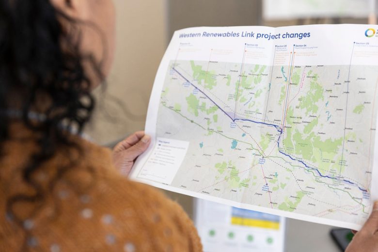
Proposed route
What will the proposed route be around Waubra?
Rather than following the existing 220kV transmission line and connecting into the existing Waubra Terminal Station as previously proposed, the proposed route now runs to the north of the existing Waubra Terminal Station. The new proposed route departs from the existing 220kV transmission line at Forest Road, running east, then turns north-east across the Sunraysia Highway. Then runs through the Waubra wind farm, turning east to follow Gallaghers Road and Coutts Road to Coghills Creek Road, which it follows south-east to join the existing proposed route at the north of Glendaruel.
Through working with landholders and technical specialists we have identified and balanced many complexities in this area. Key considerations include houses, agricultural land use, Waubra wind farm, the natural landscape including Mount Beckworth, Mount Bolton and Mount Ercildoun, volcanic cones which are recognised places of Aboriginal cultural heritage significance, and native vegetation and habitat.
We have also worked directly with landholders to understand and respond to their operational and lifestyle requirements, business, farming and property-specific issues and concerns.
We have detailed this change in the Updated proposed route (north of Waubra) fact sheet, available on the Resources page.